

Do the mountains beckon you? With 1000 miles of trail here on the Olympic Peninsula there are many adventures available.
The virtue of the Olympic Peninsula is the variety it offers. We have high mountains, lush forests and wild ocean beaches. The highest mountain, Mount Olympus is under 8000 feet so there is no shortage of oxygen. Most of the trails are dirt pathways so travel is more comfortable than rocky terrains.
We have no threatening wildlife. If respect is shown no animals will threaten you. And there are no poisonous snakes. The worst pests are mosquitoes and deer flies. These are pesky but not dangerous.
An interesting observation I have made is fellow hikers are very friendly once you get beyond a few miles from the nearest road. Distance seems to sort out people.
Distance also gives solitude. I have spent many enjoyable hours hiking. After a week of quiet solitude, the kinks of life seem to straighten out and life become much easier to deal with. God speaks to me more clearly when the world is less demanding. Many of my most happy memories have come from sitting on a log or rock listening to a distant waterfall or enjoying the peace in a mountain meadow. May you find similar rewards in your travels. As John Muir once said, “The mountains are calling and I must go.”
An Article by Ross & Kathy Hamilton
This article was put together by our own Ross & Kathy Hamilton have a love for the natural beauty of the Olympic Peninsula. The photography is from Ross Hamilton's own portfolio. It was shot on film, long before cell phones took photos.
Cick to watch Ross Hamilton speak about his time working at Ansel Adams Studio in Yosemite 
What to Bring or Consider for Your Hike
- Clothing: Multiple layers are best as they keep you warm when needed and can be removed as temperatures rise. Check weather conditions before you go, but be prepared for changing conditions.
- Hiking Gear: A day-pack with trail snacks, water, rain coat or Poncho are wise to have in this climate. Binoculars and a camera are recommended, too.
- Footwear: Good hiking boots are essential. Rough terrain requires good gripping soles and good ankle support. Heavy socks will cushion your steps.
- Hiking time: allow about 2 miles per hour, for example a 4-mile hike will take about 2 hours hiking time. All the distances listed below are one way.
- Fees: These hikes are located in various state and national parks and forests, and may require payment of a fee or purchase of a pass to use the trails and parking areas.
Spring Hikes March, April & May
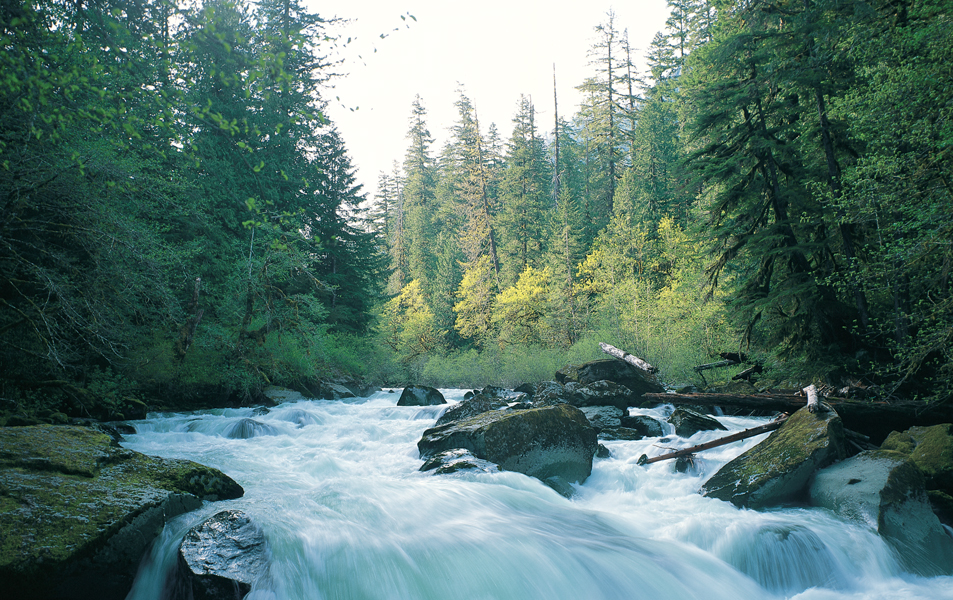
Staircase Rapids This short hike up one side and back the other lets you enjoy the beautiful Skokomish River as it flows out of the high country from glaciers and high-water drainages in the spring of the year. It leaves from the end of the road at the ranger station crossing the river on an old car bridge and follows up the west side of the river to a foot bridge a mile or so and then down the other side ending in the parking area on the east side. This hike is most impressive in March and April during the spring run-off.
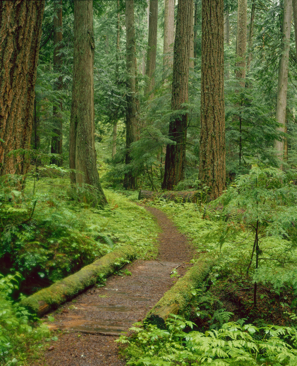
Heart of the Forest This easy 2-mile trail leaves from the East loop of the Heart of the Hills campground and winds through lush old growth forests in the 2000-foot level. You can travel as far as you want but you will have to eventually turn around and retrace your steps to the trail’s beginning. You will discover, however, that the return trip is as interesting as the going. Forest trails look very different when traveling in each direction. A late May or June visit will probably be most rewarding as spring comes more slowly at this elevation.
Fort Flagler. This state Park on the north end of Marrowstone Island is a fun place to explore with your family. Its picturesque setting offers grand views of Puget Sound, the Strait of Juan de Fuca and Port Townsend across the Bay. There are a variety of trails from beach hikes to lowland forest trails that lead past old military installations. Spring comes early here so visiting at this time of year is most enjoyable. Ships heading for Seattle and Tacoma round the end of the island coming very close to land for great close-up views.
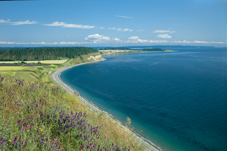
Whidbey Island Bluff This requires a ferry ride from Port Townsend to Keystone on Whidbey Island, and a short drive to Ebey’s Landing. The trail leaves from Ebey’s Landing and follows along the top of the bluff for two or three miles offering spectacular views of the Strait and the Olympic Mountains. It then drops down to the beach with a beach hike to return to your car.
Cape Alava and Sand Point This interesting area leaves from the Ozette Ranger station and can be enjoyed as two separate hikes or as a loop hike. The trails travel through lowland forests which can be very muddy so from pioneer days these trails have been made of puncheon—a type of boardwalk. Each trail leading to the ocean is about three miles. If one wants, they can walk the shoreline between the two trails and return on the other trail making about a nine-mile loop. (Be sure to check the tide tables and avoid high tide, when the shoreline may not be fully accessible.) I hiked this route in the winter once and the puncheon was so slippery that we all fell at least once en route.
Summer Hikes – June, July & August
Tubal Cain One of the first times I hiked this 3.5-mile trail in mid-June, the native rhododendrons were in bloom. The trail is lined for miles with beautiful flowers. It is an easy trail with very little gain in elevation. Once at the mine, crossing Copper creek the trail changes dramatically, opening up with stunning views of the valley and Buckhorn Peak. From here one can go another three miles either to Buckhorn Lake or Buckhorn Pass.
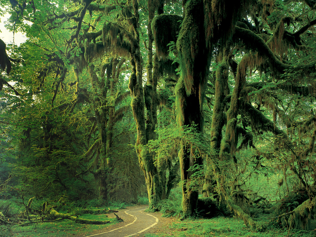
Hoh Rainforest There is no better time to visit the famous rainforest in the Hoh Valley than in June. The mosses and ferns are at their most luxurious best. Take either of the nature trails leaving from the visitor center to enjoy this stunning forest. One note of caution: it is one of the most frequently visited areas in Olympic National Park. Limited parking may create long backups at the entry station.
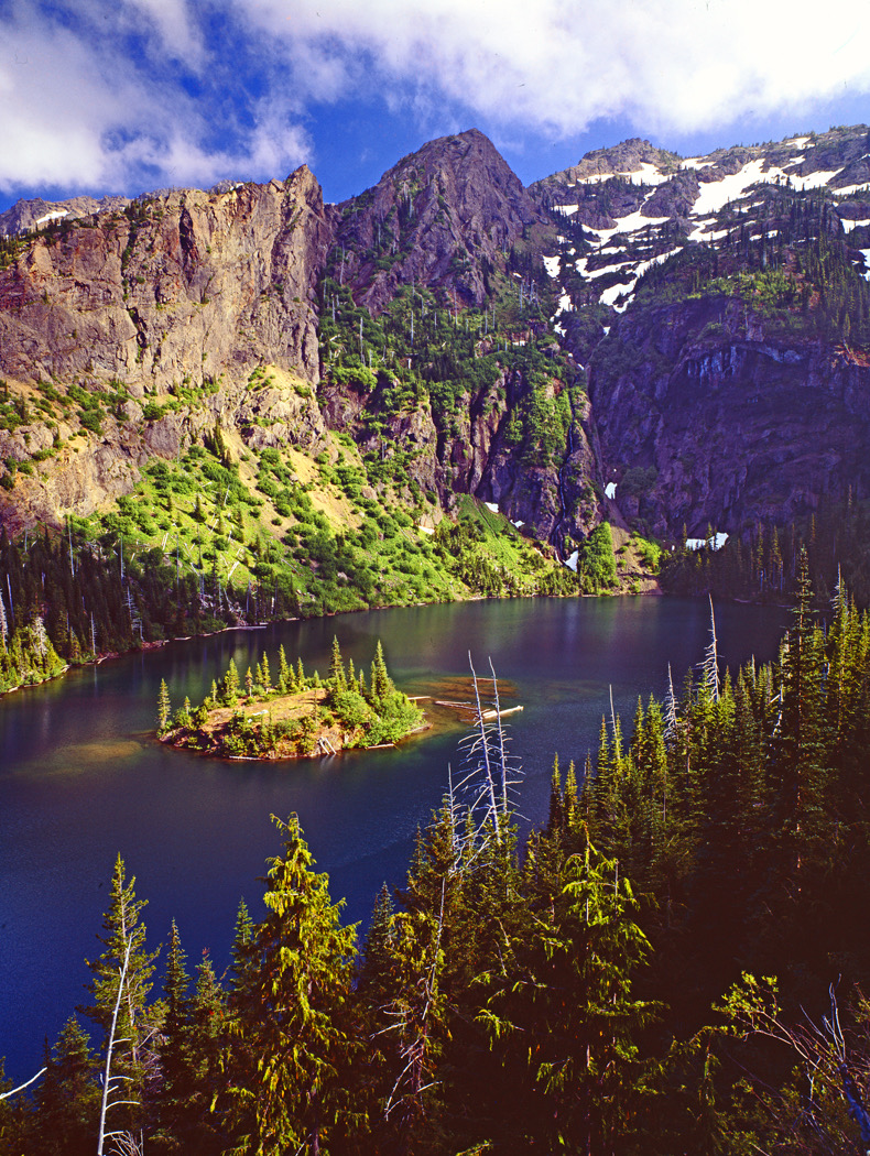
Lake Angeles Trail. This 3.5-mile trail leads you to a beautiful lake nestled up against cliffs on the side of Mount Angeles. The trail leaves from Heart of the Hills and climbs steeply to near timberline. It is best to wait until July or August as the snow may melt late in the season. Plan to spend the best part of the day enjoying this special place.
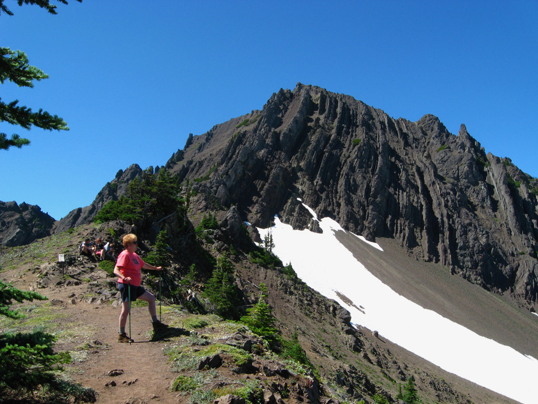
Switchback Trail This 2.2-mile trail takes off from the Hurricane Ridge road and, as the name implies, switchbacks up many times to reach Klahhane Ridge. The views are spectacular making the effort all worthwhile.
Hurricane Hill Trail How about a breakfast at the picnic ground beyond the visitor center? Then take the 1.5-mile trail up to Hurricane Hill. Morning is a beautiful time to visit this favorite area in the Olympics.
Grand Ridge Trail Leave Deer Park near the top of Blue Mountain and hike 3.5 miles out to Green Mountain. This is one of the highest trails in the Olympics and offers grand views of the Grand and Greywolf Valleys. The Greywolf Needles are very prominent from here. Hiking on around to the backside of Green Peak will give you an easy access to the summit. You will feel like you are on top of the world. The trail continues on for another four miles to Obstruction Point.
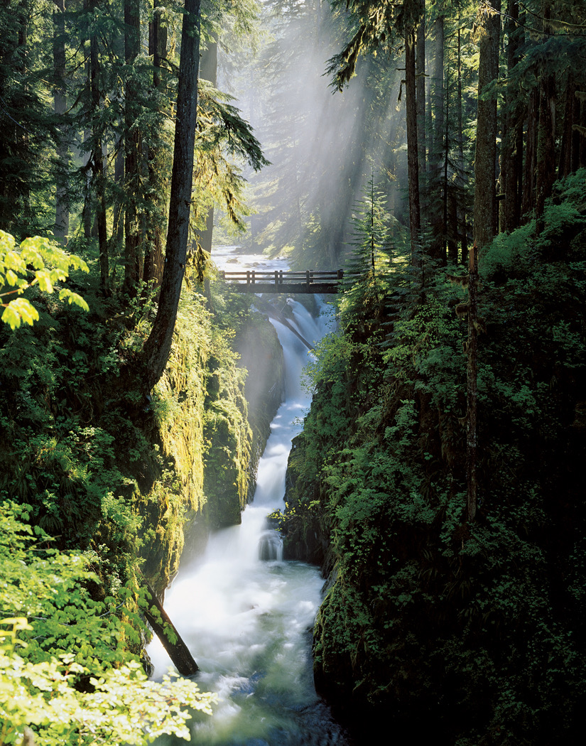
Sol Duc Falls For a very rewarding forest hike take the Sol Duc Road to its end and hike one mile to the falls. Crossing the bridge, the trail will continue for about 3 miles to Deer Lake.
Fall Hikes - September October November
Cape Flattery A nice walk from the end of the road will take you to the most northwest point of the United States. This spectacular promontory gives view of sea stack, sea caves, and Tatoosh Island. This hike is located on the Makah Reservation. You need to stop at the Makah Museum and pay the $20 dollar entrance fee before visiting the reservation. Those interested in Native American cultures will find the Makah Museum worth a visit.
Shi Shi Beach This four-mile hike takes you to one of the broadest sand beaches on the Washington wilderness coast. The Point of the Arches marks the south end of Shi Shi. It is a favorite backpack area but you can make a long day of it. Camping requires reservations and fees.
Lake Crescent The Devil’s Punch Bowl, on the north shore of Lake Crescent is a favorite with swimmers. But in the fall season it is quiet and beautiful. A foot bridge spans its entrance to the lake. To reach it the best approach is to follow the Discovery trail for about a 1/2 mile at the east end near Log Cabin resort, and watch for a side trail off on the left before the first railroad tunnel. You can make a loop by watching for a trail on the other side of the bridge which takes you back to the paved Discovery Trail and pass through the tunnel back to the trailhead.
Dosewallips State Park Explore the trails leaving from the park. In the fall the trail passes through a beautiful golden bigleaf maple forest. The park is near Brinnon on Highway 101 along Hood Canal, and is easy to reach.
New Dungeness Lighthouse Take a 5.5-mile hike out to the lighthouse at the end of the longest sand spit in the western hemisphere. This is best done on an outgoing tide. Otherwise you may be jumping over drift logs. The lighthouse was built at the end of the spit in 1857 but today is a half mile from the end because the spit continues to grow. You may wonder why it is called the “New Dungeness” lighthouse. That is what this area was named by George Vancouver in 1792. And it been “new” ever since.
Rialto & Second Beach These are two very different beaches very close together. Rialto is a rather steep pebbly beach that makes walking somewhat difficult with lots of wave activity. Walking to Hole In The Wall about 1 mile makes a rewarding trip with sea stacks at the north end. Second Beach just south of La Push is a wide sandy beach with gentle waves. Second Beach requires a 2-mile hike down a long stairway with unpredictable driftwood logs at the entrance. Both beaches are rewarding but tides should be taken to account.
Click to learn more about the author and photogapher Ross Hamilton